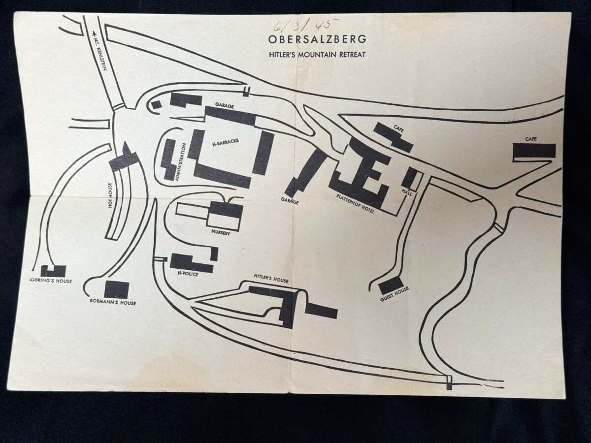
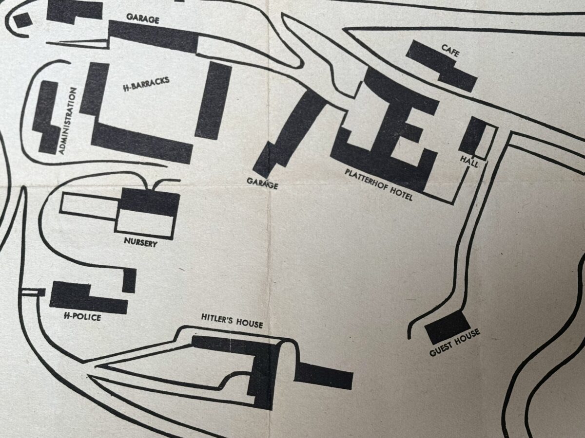
Map of Obersalzberg, Hitler’s mountain retreat. Small map that was handed out to Gi’s visiting the site. It measures about 29 × 21 centimeters. The map was printed on low grade paper and not many survived. It was most likely printed in 1945, apparently for use of the first US soldiers who reached the area.
The map shows us and was folded but it is superb for display and will look awesome framed. Good condition.

GI SNAPSHOTS OBERSALZBERG 1945
February 11, 2024